

SURVEY EFFICIENCY IN REMOTE ALASKA
GPS Inc. provides a variety of surveying, platting, and mapping services for Federal, ANCSA Native, and State of Alaska Lands. GPS Inc. also provides positioning for photo and LIDAR control and utility and ROW control.
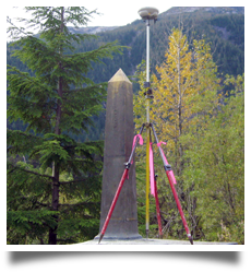 |
ESTABLISHING CONTROL WITH GPSGPS Inc. has established over 100 miles of rectangular boundaries for the logging industries on Afognak Island. In the early years, GPS Inc. worked extensively in the Bristol Bay region subdividing native allotments (U.S. Surveys), locating gravel test holes, and doing volumes for large gravel pits & air fields. Through the 90's the company located water elevations on many lakes for the fish and wildlife service among the wildlife refuges in Alaska, and spent time in Southeast Alaska setting control for mine tunnels. |
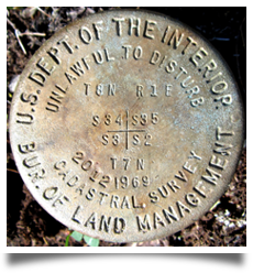 |
MONUMENTING "ALASKA NATIVE CLAIMS SETTLEMENT ACT" (ANCSA) NATIVE LANDSIn the spring of 1994, Tom & Stan pioneered the use of global positioning systems for cadastral surveys. GPS Inc. was the first to demonstrate to the Bureau of Land Management (BLM) that GPS technology could be used to survey & monument ANCSA lands. Our primary area of specialization has been surveying & platting native allotments and townships under agreements with Alaskan tribes that use the PL 93-638, Indian Self Determination and Education Assistance program to contract with the BLM to survey & map their ANCSA land selections. Under the Tribal 93-638 program, GPS Inc. has surveyed over 600 native allotments, over 190 townships for 12(a) and 12(b) final entitlement lands, and has designed & surveyed many ANCSA 14(c) reconveyances. Through these processes, the company has recovered & set over 5,300 monuments and surveyed over 550 miles of water boundaries. |
|---|---|
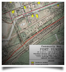 |
COMMUNITY PROFILE MAP PRODUCTIONSince 2001, GPS Inc. has set the standard of excellence for community profile mapping. To date, GPS Inc. has produced 177 Alaskan Community Profile Maps for the State of Alaska Department of Commerce, Community & Economic Development. GPS Inc. was the first to use color aerial photographs for these profile maps. GPS Inc.'s drafting standards have been adopted as the State's standard for future projects. |
 |
STATE LAND DISPOSALGPS Inc. began surveying for the Department of Natural Resources (DNR) in 2006, defining & platting remote cabin sites and remote subdivisions. The company has completed approximately 14 different remote contracts for the DNR. |
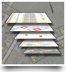 |
GEOGRAPHIC INFORMATION SYSTEMS (GIS) MAPPING FOR COMMUNITIES & BOROUGHSDuring the surveying & mapping of villages in the Bristol Bay region, the need for a modern method of accessing the land information by community & borough planners was necessary. GPS Inc. answered the need by developing GIS Projects using standardized formats that could be utilized in rural communities and be integrated by borough & government agencies. One key element of the company's GIS projects was to enable village offices to perform an interactive parcel query which would display four or five geographical-informing items unique to that particular parcel, allowing them to visualize & analyze for any future planning. |
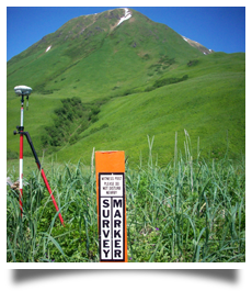
PHOTO & LIDAR CONTROLGPS Inc. provides photo & LIDAR control to the photogrammetry firms within the state. When these firms are performing work in remote parts of the state, GPS Inc.'s company helicopter provides economical transportation to assist these firms by setting & controlling photo panels. When LIDAR is utilized, GPS receivers must be operated continuously, the GPS Inc. team provides assistance in keeping these receivers powered-up. The company-owned helicopter makes ground proofing for LIDAR easier to perform as long lines of profile elevations and positioning must be determined throughout the project via GPS technology. |
|
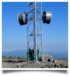 |
REMOTE UTILITY LOCATIONGPS Inc. is involved in the location and the control of remote communication tower sites. After these communication towers are erected, GPS Inc. returns to the project location to certify the required as-built survey. Prior to cell site approval, the company determines any elevation obstructions in the line-of-sight between cell towers with GPS recievers aboard the helicopter. |